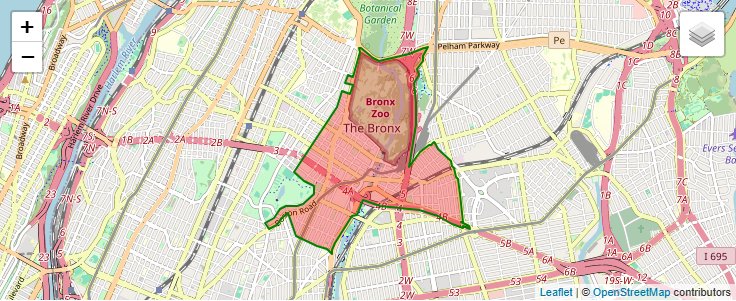
10460 can be classified socioeconomically as Lower Middle Class class compared to other ZIP Codes in New York based on Median Household Income and Average Adjusted Gross Income. The majority race/ethnicity residing in 10460 is Hispanic. The majority race/ethnicity attending public schools in 10460 is Hispanic. The current unemployment level in 10460 is 4.4%.
| Population | 59,852 |
| Population Growth Rate | -1.3% |
| Population Density | 39,506 People per Square Mile |
| Total Households | 19,359 |
| Percentage High Income Households | 0.2% |
| Median Household Income (2021) | $31,504 |
| Average Adjusted Gross Income (2021) | $308,880 |
| Current Unemployment Rate (May 2026) | 4.4% |
| Sales Tax Rate (2025) | 8.9% |
| Majority Race/Ethnicity | Hispanic - 56.1% |
| Public School Majority Race/Ethnicity | Hispanic - 67.06% |
10460 Race/Ethnicity Breakdown
| Race/Ethnicity | Total | Percentage |
|---|
| White | 9,533 | 13.37% |
| Black | 20,511 | 28.76% |
| Hispanic | 39,939 | 56% |
| Asian | 827 | 1.16% |
| Native American | 381 | 0.53% |
| Hawaiian/Pac. Islander | 124 | 0.17% |
10460 Public School Race/Ethnicity Breakdown
| Race/Ethnicity | Total | Percentage |
|---|
| White | 135 | 1.44% |
| Black | 2,460 | 26.28% |
| Hispanic | 6,308 | 67.39% |
| Asian | 322 | 3.44% |
| Native American | 106 | 1.13% |
| Hawaiian/Pac. Islander | 29 | 0.31% |
10460 Educational Attainment Levels
| Highest Education Level | Total | Percentage |
|---|
| Less Than 1 Year of College | 975 | 4.88% |
| Bachelor Degree | 2,645 | 13.23% |
| High School Diploma | 7,250 | 36.27% |
| No High School Diploma | 1,047 | 5.24% |
| GED or Alternate | 1,637 | 8.19% |
| 1 or More Years of College | 3,538 | 17.7% |
| Associates Degree | 2,241 | 11.21% |
| Masters Degree | 549 | 2.75% |
| Professional Degree | 99 | 0.5% |
| Doctorate Degree | 6 | 0.03% |